We enjoy reading about new research and development of robots, and we’re happy enough to watch them “dance” or toy with the idea of having them help with distinctly human tasks. We’ll even speculate on how well they might be able to replace human workers in the future. But we really like to see robots doing needful jobs that human beings can’t do as well or as safely as automation can.
A great new example is the mapping of icebergs. Researchers from two U.S. universities on the opposite sides of the country are currently working to create robots that can map icebergs effectively and safely.
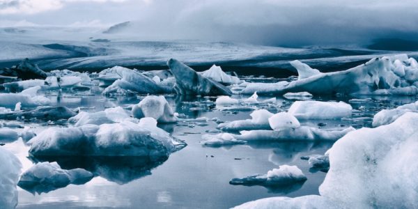
The trouble with icebergs
Between climate warming and increasing global mobility, information on icebergs is greatly needed. The problem is, most of an iceberg is always under the water where it can’t easily be seen. Human beings on a ship can’t safely get any closer to an iceberg than about 164 feet — and since you won’t know where the edges are, the real-world distance has to be a bit more than that.
Icebergfinder.com has a very cool collection of iceberg pictures and information, including maps. They get their data from satellite images and crowdsourced reports, not from direct measurements. C-CORE using data from the European Space Agency (ESA), the Canadian Space Agency (CSA), and the National Aeronautics and Space Administration (NASA). The human sightings come from travelers and “ambassadors.” It’s a terrific project. They’re doing something wonderful, but they have limitations.
ArcGIS has a map of antarctic icebergs and lots of resource links. Synthetic Aperture Radar (SAR), visible, and infrared remotely sensed imagery inform the images.
What’s the next step?
Robots to the rescue!
Researchers Mingxi Zhou and Chris Roman from the University of Rhode Island, and Zhuoyuan Song from the University of Hawaiʻi at Mānoa, received a $1.5 million award from the National Science Foundation to develop a robotic mapping project for icebergs.
They’re planning autonomous underwater and surface vehicles plus a number of floating platforms. The robots will be able to get close enough to the icebergs not only to see them clearly, but also to measure the characteristics of the water directly around them. This will provide information on shape and size as well as the speed with which they are moving and melting.
Since icebergs move and change, developing algorithms to navigate the robots around the icebergs can be tricky. It’s easy to end up with skewed data because of the changes that take place over time, while the robots are doing their work.
The project, which will last for several years, will include workshops and filed trips for local students, arts components, and other kinds of public engagement. “Training students and inspiring our next generation are essential and should always be the top priority for innovation and technology development,” said Zhou.
It’s an exciting and practical project, which we will watch with interest.